…and a couple of examples about how the more things change, the more they stay the same. Or change.
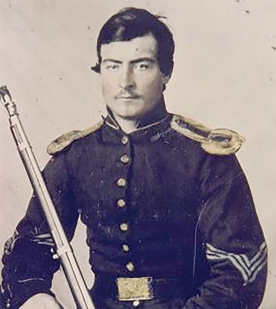
While we’re dealing with our arctic blast, I’ve been wondering what the weather was like in the winter of 1861-1862, the first winter of the Civil War. Why? Because of the letters of a 23-year-old soldier named John Williamson, a member of the Pennsylvania 81st Volunteer Infantry who wrote dozens of letters home to his pregnant wife Hester during his time in military service. Those letters, kept by members of John’s family for generations, recently found their way to me (Hester’s second husband was a few-greats uncle of mine). I put John’s letters into a book that can be found on Amazon.
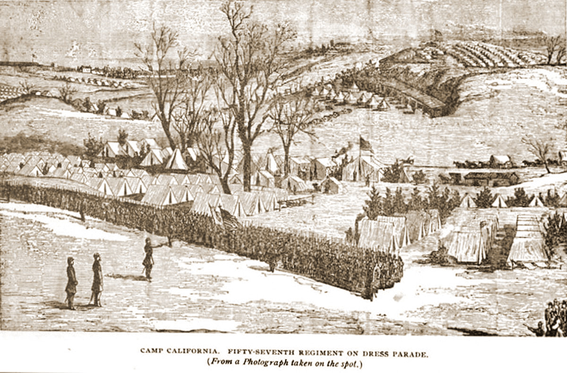
In January 1862, John and the rest of the Pennsylvania 81st regiment were part of Sumner’s Division, which took part in defending Washington, D.C. Their winter camp, Camp California, was near Seminary Hill outside of Alexandria, Virginia which is across the Potomac River from Washington. Below is a drawing of Camp California.
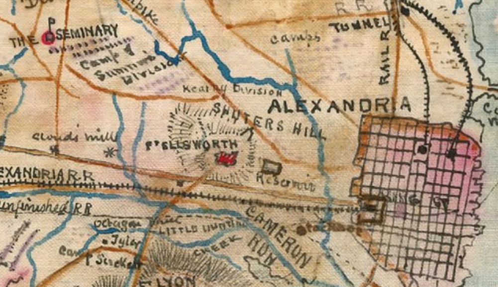
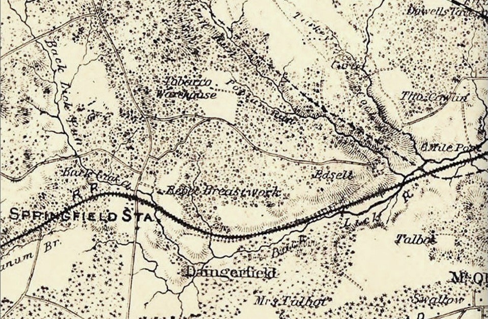
On the 1861 map below, Alexandria is on the right and the Seminary is in the upper left corner. Just below the Seminary can be seen “Camp of Sumner’s Division”. The roads are indicated by dark gold lines.
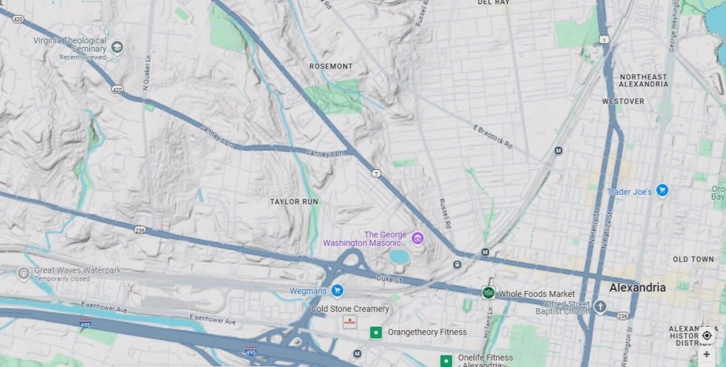
Below is a present-day map of the same area. The Virginia Theological Seminary, some of its buildings dating back to the 1850s, is still in existence and is seen in the upper left corner of the map. It’s fascinating to see how the major roadways are in the same location on both maps. One example is Leesburg Pike (its name then and now), the uppermost branch of the forked road which becomes King Street as it nears Old Town Alexandria. Another is Little River Turnpike (its name then and now), the bottom-most straight line (just above the railroad on the 1861 map) which becomes Duke Street.
But while the roadways and rail line are basically in the same locations, very little else is similar between 1862 and 2025. This is a heavily developed, heavily congested traffic area that looks nothing like the rolling farmland it was 163 years ago.
John Williamson mentioned the weather conditions in some of his letters while also describing what was going on with and around him: “Camp California, Jany 23, 1862. Dear Wife, I now sit down to write you to let you know that we are all pretty well at present…Having just come off picket this afternoon, I am not in much humor of writing…As I expected, we had to go on picket on Sunday. We started from camp about nine o’clock. It was awful muddy, so that we couldn’t make much headway, and it kept raining a little all day...”
The muddy conditions were also mentioned in a letter to the Philadelphia Inquirer dated January 22, 1862, by a soldier in the Pennsylvania 53rd regiment who was also stationed at Camp California: “…The weather, the great universal topic of conversation, has been compelled to succumb to its rival, mud. The anticipated…advance of the army is constrained to yield for a time to mud. Mud controls everything here…”
John’s January 23rd letter went on: “…We reached the hill about noon…” In January 1862, soldiers from regiments of Sumner’s Division were sent to picket (be on the lookout for the enemy) on Edsell’s or Edsall’s Hill, according to a soldier’s letter in the New York Daily Herald. On the 1861 map below, “Edsell” can be seen in the middle-right part of the image. Also seen is the heavy curving line indicating the railroad, as well as “Springfield Sta(tion).”
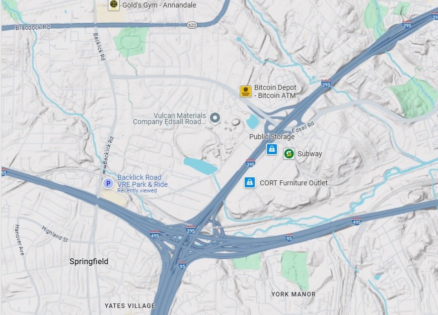
Below is the same area on Google Maps. Once again, we can see that major transportation arteries are in the same locations in 1862 and 2025: Backlick Road (the north-to-south road toward the left on both maps), Edsall Road (a horizonal curving line in the middle of the maps) and the rail line (a heavy black curving line in the 1862 map, a curving gray line just above the horizontal thick gray line for the Beltway on the Google map).
Today, there’s nothing at the site of the hill to indicate its history except Edsall Road’s name (above the word “Subway” on the map below). Edsall’s Hill itself is in the approximate location of the word “Subway” and the location of a community called Bren Mar, a subdivision of houses built in the 1950s-1960s. Where the Springfield Station was located is now the Backlick Road park and ride for the Virginia Railway Express (VRE).
John mentioned the weather again in his January 15, 1862 letter: “…Snow last night again, and keeps snowing a little today, in consequence of which there is no drilling today. Some folks think and so I did myself that if they were once down in Dixie they would be out of the cold. I can tell anyone if there is any that are under that impression that they are a little bit mistaken. I dare say that the weather is colder up there than it is here, but the circumstances are different also…”
According to an article by Meg Groeling on the Essential Civil War Curriculum website, “…The…Civil War took place at the end of what is called the Little Ice Age…By the time the Civil War began, the Little Ice Age was ending…Virginia experienced alternating extreme precipitation, scorching heat, and bitter cold…”
Sounds familiar.
